Everest Base Camp Trek Distance, Length & Elevation
The Everest Base Camp Trek (EBC Trek) is one of the most legendary travels on ground. For a lot of trekkers, being at the lowest point of the highest mountain in the world is to see their dream fulfilled. But still, asking how long a trek is, is the first question that comes to most people’s minds. What is the distance? How high is Everest Base Camp? These questions have no easy answers as you might guess.
The Everest base camp Trek distance varies according to your route, the number of days for acclimatization, and if you just walk to Base Camp or also use the side trails. Also, the altitude chart changes with different versions of the route. Here, we are going to discuss all the things you should know about distance, length, and elevation of the Everest Base Camp trek in 2025, along with day-by-day breakdown, acclimatization tips, and preparation advice. So, you will know well what to expect before starting the legendary trail.
Distance & Elevation
The trek to Everest Base Camp takes you on a 130 km (80 mile) round journey from Lukla to Base Camp and back. The distance itself might not sound intimidating, but the hard part is the steep, rugged trails, high suspension bridges, and thin mountain air. Trekkers usually cover a distance of 10–15 km per day with a time span of 5–7 hours, and the whole journey goes up to 12–14 days, which includes two days for acclimatization. Additionally, a helicopter return can make shorter itineraries of 7–9 days and longer routes of 18–21 days (with Gokyo Lakes or Three Passes) possible.As distance, elevation profile is just as significant.
Starting off at Lukla (2,860 m / 9,383 ft), the trek moves up little by little through Namche Bazaar (3,440 m), Tengboche (3,860 m), Dingboche (4,410 m), Lobuche (4,940 m), and Gorakshep (5,164 m) respectively, and it doesn’t stop here, it continues to Everest Base Camp at 5,364 m (17,598 ft). Most of the trekkers make a trip to Kala Patthar (5,545 m / 18,192 ft), which is the highest point of the trek, to have a view of Everest when the sun rises. The trek in total goes up from Lukla to Base Camp nearly 2,500 m (8,200 ft), but the climb is divided amongst several days for safe acclimatization.

Breakdown -Distance and Elevation
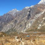
The Everest Base Camp trek Adventure is the one known for being among the best walks in the world as it combines the stunning view of the Himalayan, the profound Sherpa culture, and the incredibly fantastic feeling of being available at the bottom of Mount Everest. Usually, it is a 12-day round trip trek from Lukla during which almost 130 km is covered and the altitude goes up gradually like this – starting at 2,860 meters (Lukla), reaching 5,364 meters (Everest Base Camp) and the highest point is 5,545 meters (Kala Patthar).
Here is daily summary of EBC trek specifying the distance, elevation, hours, and the main experiences.
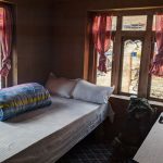
Day 1: Lukla to Phakding (2,860m → 2,610m | 8 km | 3-4 hrs): The trek is, first of all, the short but spectacular flight to Lukla’s well-known mountain airstrip. After that, the trail follows the Dudh Koshi River which is a descent by a few meters and during the journey, passing the prayer wheels, suspension bridges, and the adorable Sherpa villages. In other words, this first day with a distance of 8 km is an easy day to get used to the altitude and the trekkers can rest at Phakding (2,610m).
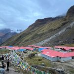
Day 2: Phakding to Namche Bazaar (2,610m → 3,440m | 11 km | 6–7 hrs): This is the first bumpy day on the trail. The trail goes through pine forests, crosses suspension bridges (including the famous Hillary Bridge), and then enters Sagarmatha National Park formally. The last 2-hour uphill walk is really hard; however, as you get to Namche Bazaar (3,440m) – the lively Sherpa center that offers you mountain views, cafés, and shops – it becomes so worth it.
Day 3: Acclimatization in Namche (3,440m | 3–5 km side hike): Just for the purpose of acclimatizing, trekkers stay in Namche for an additional day. The side walks are a breathtaking view of Everest, Ama Dablam, and Lhotse or a trip to Khumjung village, the place where the Hillary School is. This “rest day” is more of 3-5 km of easy hiking to get the body adapted to the high altitudes.
Day 4: Namche to Tengboche (3,440m → 3,860m | 10 km | 5–6 hrs): On this scenic stage, you can find some of the earliest magnificent views of Everest and Ama Dablam. Firstly, at Phunki Tenga, you descend to the river and then the path climbs steeply through pine and rhododendron forests until you reach Tengboche (3,860m), the largest monastery of the area. Evening prayer ceremonies are a cultural highlight here.
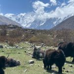
Day 5: Tengboche to Dingboche (3,860m → 4,410m | 11 km | 5–6 hrs): The next part of the trek is the descent to the Imja Khola River, which is then followed by a steady climb by Pangboche village. The first signs of the alpine landscapes have been overcome once the trekkers spot the last trees. The day’s journey comes to an end in Dingboche (4,410m), the village surrounded by stone-walled fields and wide valleys.
Day 6: Acclimatization in Dingboche (4,410m | 4–6 km side hike): The second day for acclimatization is also very essential for the body to get used to the lack of oxygen. Most trekkers choose to do Nagarjun Hill (5,100m) to enjoy the great views of Makalu and Island Peak or take a short route to Chhukung Valley. The six kilometers stage is very steep and, thus, very important for the upcoming altitudes.
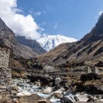
Day 7: Dingboche to Lobuche (4,410m → 4,940m | 8 km | 5–6 hrs): After one or two ascents that are not very too hard, the trail passes Thukla (4,620m) and then goes up steeply to Thukla Pass. This is the place where memorials to climbers who died on Everest are located. The next part of the journey is following a glacial moraine with a fantastic view of Nuptse and Pumori until reaching Lobuche (4,940m).
Day 8: Lobuche to Gorakshep + Everest Base Camp (4,940m → 5,364m | 15 km round trip | 7–8 hrs): This is the most awaited day. The path from Lobuche leads along the Khumbu Glacier up to Gorakshep (5,164m), the last settlement before Base Camp. After freeing themselves from the load, trekkers move 3-4 km further to reach Everest Base Camp (5,364m). It is really impossible to forget standing amidst ice formations and expedition tents at the foot of the tallest mountain of the world. Just after taking pictures and celebrating, the trekkers go back to Gorakshep for the night.
Day 9: Gorakshep to Kala Patthar, then Descend to Pheriche (5,164m → 4,240m | 13 km | 7–8 hrs): The best sunrise view of Everest, glowing golden alongside Nuptse, Lhotse, and Pumori can be had by a pre-dawn climb up Kala Patthar (5,545m). This is the highest point of the trek. After a descent for breakfast, the trek continues down to Pheriche (4,240m) where the air is thicker and therefore feels like relief.
Days 10–12 Return to Lukla (65 km over 3 days): The way back is the same as the one coming, so the trekkers pass through Tengboche, Namche, and Phakding again before they arrive at Lukla. Although it is long (65 km in total), the descending is easier and, therefore, the trekkers can enjoy the familiar trails as if they were new. They have a celebration with their crew in Lukla before the flight to Kathmandu.
Altitude & Acclimatization
At the first view, the Everest Base Camp trek does not seem to be very scary going 130 kilometers round trip in 12 days means that you are covering the distance by only about 10-12 kilometers a day. However, the actual problem is altitude, terrain, and climate combination.
- Altitude: When you reach the high mountain areas, the air becomes thin. At Base Camp, the amount of oxygen is approximately half as much as at sea level. Here is why days for getting used to the altitude in Namche Bazaar and Dingboche are so important. If they are not included, trekkers are in danger of getting Acute Mountain Sickness (AMS) which is characterized by such symptoms as nausea, headaches, dizziness, and tiredness. The principle of safety is “climb high, sleep low” and never be hasty.
- Terrain: The trek is not along a horizontally level trail. At low altitudes, it goes through green forests and over hanging bridges while at Base Camp, the surroundings are rocky moraines and glaciers. No day is the same, and the hardest part of the trip (like the walk up to Namche) is the steep ascents that are very exhausting.
- Climate: One moment, it can be a clear sky with the sun shining in the Himalayas and the next, a snowstorm can be raging. Besides cold nights and thin air, the weather also adds to the difficulty and thus, every kilometer feels longer than it really is.
Routes of Distance
The mixture of these factors is the reason why the trek is rated as moderate to strenuous. Although technically it is not a mountain climb, it requires a lot of stamina, patience, and a calm pace. Most fit trekkers if they have acclimatized properly and are well prepared can do it however, failing to recognize altitude as the main cause of problems is the number one mistake people make.
Routes & Seasons: Making the Distance Achievable Though the traditional Lukla–Everest Base Camp–Lukla route is about 130 km, there exist several route variations:
- Jiri to EBC (170 km / 18–21 days): The way of going the long way round that was before Lukla flights.
- Three Passes Trek (160–170 km / 18–21 days): A circuit that is more difficult with the crossing of the Renjo La, Cho La, and Kongma La.
- Gokyo Lakes & Cho La Pass (145 km / 14–18 days): Glaciers and high passes are combined with the milky turquoise lakes of the region.
- EBC + Helicopter Return (65 km one way / 7–9 days): A trip for those who do not have enough time and are going on the trek only in ascending mode.
If you look at it from the time perspective, when is the best time to make such a long walk also very dependent on. The best seasons are spring (March–May) and autumn (September–November). In these times sun is shining and the weather is stable which means trails are clear and the sky is blue. It is quite the opposite in winter when there is a lot of snow on the trails and the cold is very severe at night and during the monsoon season the trails become slippery and the visibility is low. Deciding which season is the most suitable for the trek will not only let the distance be more manageable but also enjoyable.
Walking in the Everest Base Camp trek is not only about completely the 130 km, it is a change of scenery and peoples along with new cultures that you meet as you go from the green valleys and forests to the sherpa villages, visiting the monasteries, and finally the glaciers and the snowfields near Base Camp. Being at Base Camp or Kala Patthar means you have also experienced different climate zones as well as passing through hundreds of years of Himalayan tradition. It is not only the destination but also the way that makes it unforgettable. For 2025, train early, choose the right season and route and with the help of Adventure Great Himalaya, you will be having your perfect trek planned in no time.
Speak to our local travel expert, who can assist you in planning your trip.
PLAN YOUR TRIP OR
Chat via WhatsApp
Tuesday, September 2nd, 2025
Everest Base Camp Trek Distance, Length & Elevation
 Saturday, August 30th, 2025
Annapurna Base Camp Trek vs Mardi Himal Trek
 Wednesday, August 27th, 2025
Navigating the Khumbu Ice fall
 Wednesday, August 20th, 2025
Trekking in Nepal in 2025 /2026 : What’s New & What’s Changed?
 Wednesday, August 20th, 2025
Annapurna Base camp Trek in December
 Wednesday, August 13th, 2025
Is Annapurna Base Camp Trek Safe?
 Wednesday, August 6th, 2025
Is Annapurna Base Camp Harder Than Everest?
 Monday, July 7th, 2025
Langtang Valley Trek Accommodation
 Thursday, July 17th, 2025
Annapurna Base Camp Trek in November
 Monday, July 7th, 2025
Best Time to Hike Langtang Valley
 Friday, May 9th, 2025
Annapurna Circuit Trek In August
 Saturday, June 14th, 2025
Langtang Valley Trek In March
 Wednesday, June 25th, 2025
Langtang Trek In May
 Tuesday, August 5th, 2025